Introduction and Scope
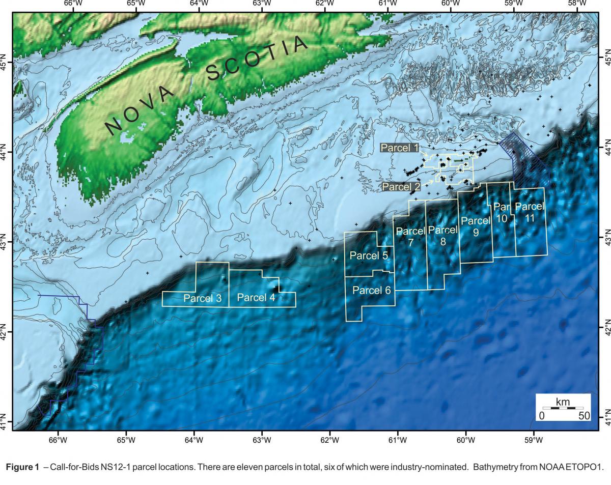
 The eleven parcels included within the 2012 Call for bids cover a large area and are distributed across both the central and southwestern regions of the Scotian Margin in shallow and deep water (Figure 1). Parcels 1 and 2 are located on the Scotian Shelf within the Sable Subbasin. These parcels are in close proximity to numerous significant oil and gas discoveries, producing fields and the related infrastructure.
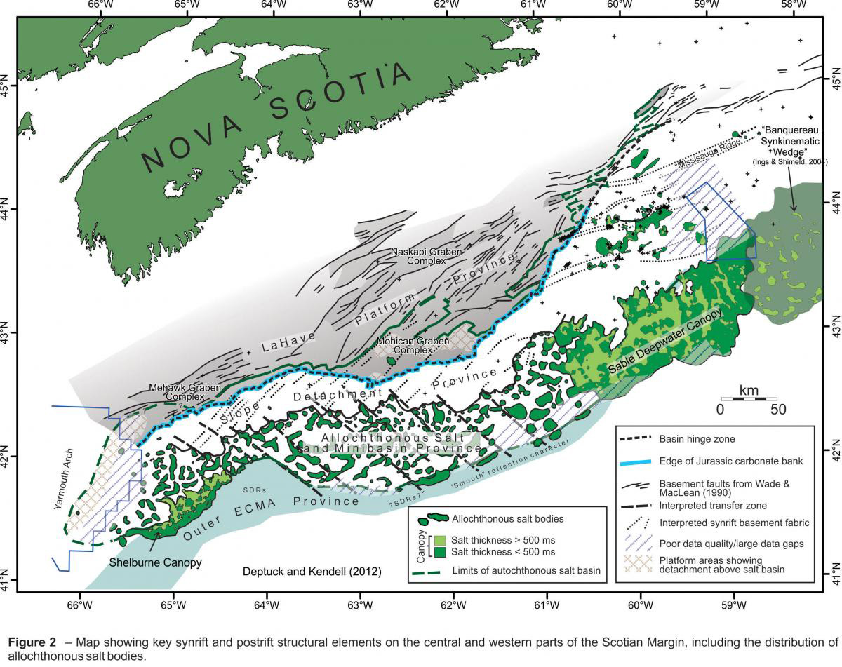
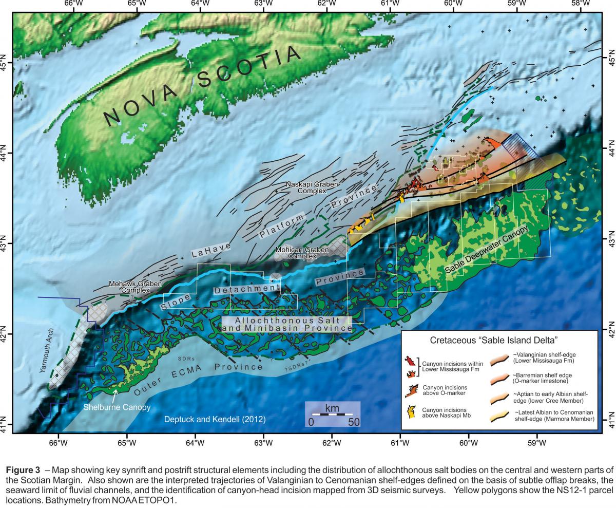
 Parcels 3, 4, 5 and 6 are in deep water on the western Scotian Margin surrounding the licences recently awarded to Shell Canada Ltd. These parcels lie within the Slope Detachment and Allochthonous Salt and Minibasin provinces that were previously identified within the NS11-1 Call for Bids (Figures 2 and 3).
 Parcels 7-11 lie on the Central Scotian Slope downdip from the Sable Delta in an area where gas charge is proven in Cretaceous turbidite sands at both the Newburn and Annapolis wells. Recent CNSOPB studies have improved the understanding of shelf edge trajectories throughout the Cretaceous and also identified multiple periods of shelf edge canyon erosion that transported coarse clastics to deepwater (Figure 3). These turbidite deposits loaded the salt canopy throughout the Cretaceous and into the Tertiary; inverted minibasins are common structures within these deepwater parcels.
This call for bids website is divided into two main sections. For details regarding parcels 1, 2 and 7-11 refer to the Central Scotian Margin section, and see the Western Scotian Margin section for information specific to parcels 3, 4, 5 and 6.
Note: This website is actively being updated with new material. To ensure you have the most recent content of the CFB NS12-1 package, please check back periodically.