
CANADA-NOVA SCOTIA OFFSHORE PETROLEUM BOARD


Exploration History
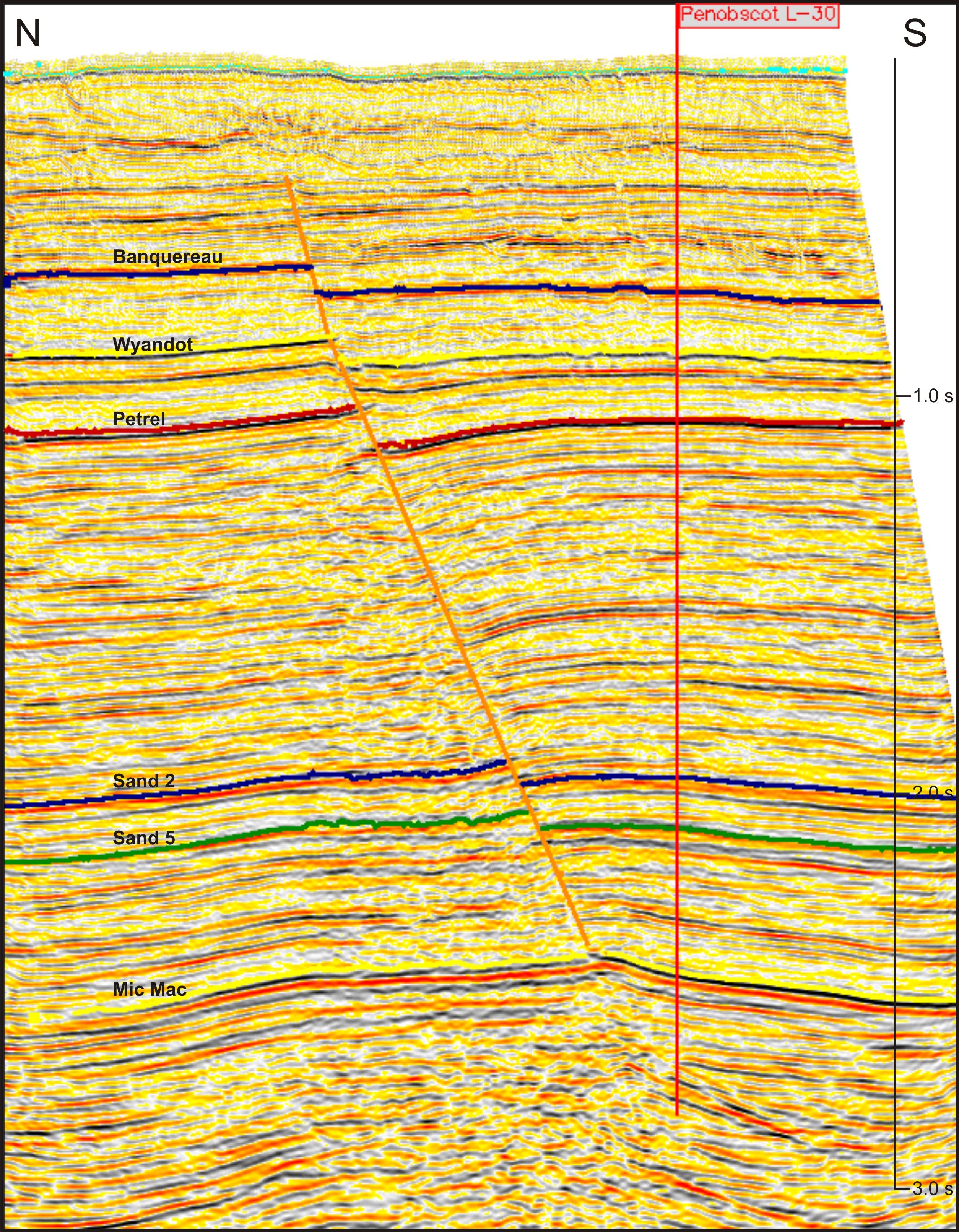
FIGURE: 10
Parcel 1 is located 30 km northeast of the Thebaud production platform in water depths ranging from 50 to 200 m. The initial well on the structure, Penobscot L-30, was drilled by PetroCanada-Shell in 1976 to a depth of 4237.5 m in 138 m of water. Hydrocarbons were recovered by Repeat Formation Tester (RFT) from four Middle Mississauga sands. Figure 10 is a dip line through the L-30 well showing a low relief faulted anticline.
A second well, Penobscot B-41, was drilled by Shell-PetroCanada in 1977. This well is 3 km to the northwest and at the time was believed to be up-dip of L-30, on the same structure. The B-41 well reached a total depth of 3414 m in 118 m of water. Figure 11 is a dip line through the B-41 well. No significant hydrocarbons shows were encountered and no formation tests were run. The stratigraphic tops in B-41 were within 10 m of the tops in the L-30 well suggesting that B-41 was not substantially up-dip of L-30. Recent 3D mapping and depth conversion demonstrate that B-41 may have been drilled into a separate closure.

FIGURE: 11
Approximately 13 km to the southeast from L-30, Shell Canada Resources drilled South Desbarres O-76 in 69 m of water and on a separate structure in 1984. This well reached a total depth of 6039 m and did not encounter any hydrocarbons.
After the licence was relinquished by Shell, Nova Scotia Resource Limited (NSRL) obtained an Exploration Licence over the Penobscot prospect in 1989 and acquired 66 km2 of 3D seismic. The interpretation report for this survey, completed in 1991, including synthetics and depth conversions, is available here. The maps are available from the GRC. A second report, completed in 1992, included further mapping and reserve estimates. This report identified further potential northeast of the original mapped Penobscot prospect that has yet to be tested. This interpretation report is available here.
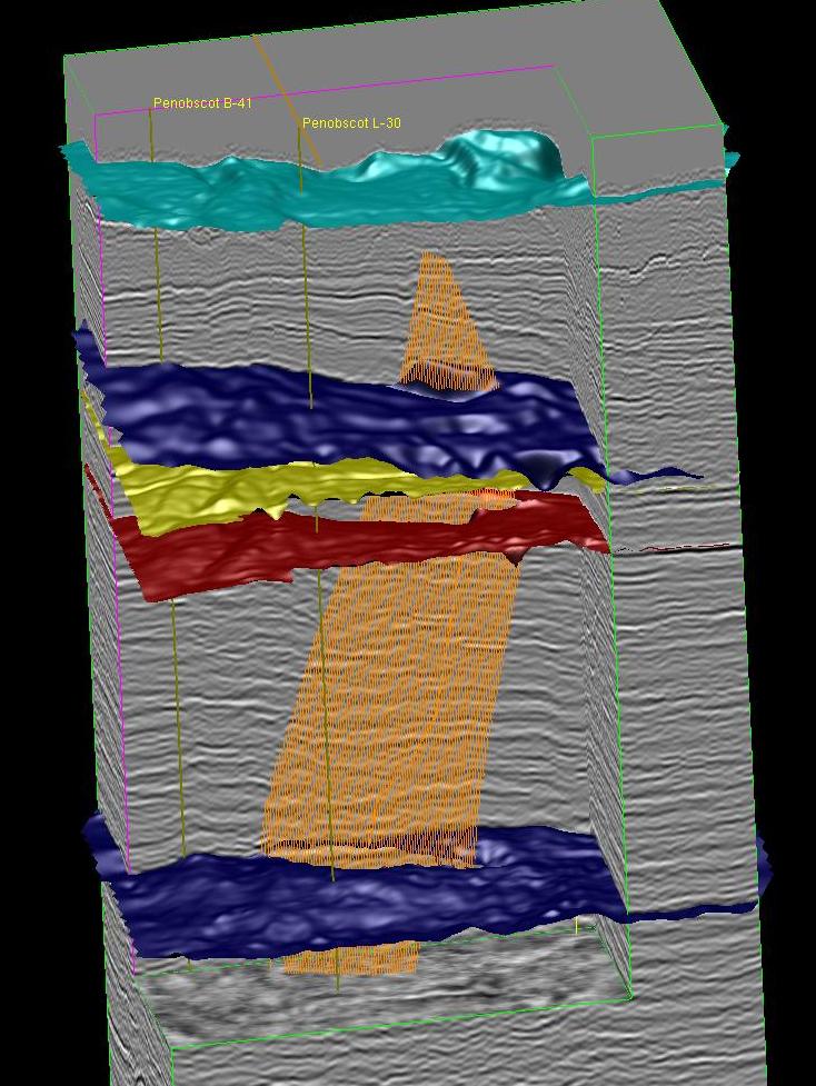
FIGURE: 12
The Penobscot 3D seismic data is now owned by the Province of Nova Scotia and will be made available to the public, in digital form, at no charge. Figure 12 shows the data cube with recent interpretation completed at the CNSOPB. The Province of Nova Scotia has had the 3D seismic reprocessed to improve the data quality. This reprocessed data will also be made available.
A number of seismic surveys have been acquired over portions of the Parcel 1 since the early 1980s. Interpretation reports are available for most of these programs. The NS24-N011-001E program is the 3D program that is now available in digital form at no charge.
| Seismic Program # (links by program) | Operator(links by company) | Year |
| 1980 | ||
| 1981 | ||
| 1982 | ||
| 1983 | ||
| 1984 | ||
| ICG Resources | 1983 | |
| NSRL | 1985 | |
| PetroCan | 1985 | |
| NSRL | 1992 | |
| Mobil | 1998 | |
| Western | 2001* | |
| 2001* | ||
| 2002* |
* These programs are confidential
Click here to open the complete seismic coverage map.